Johnny Boy's Walkabout Blog
... bushwalking in the ACT and nearby NSW
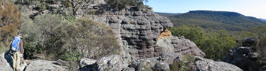
28 Jun 15 | The top of Binnari Pass to Quiltys Mountain, the Budawangs, Morton NP
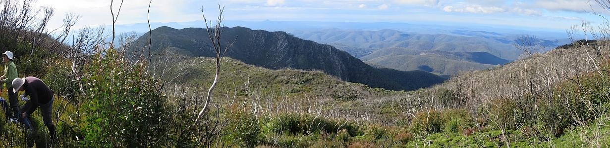
30Jun 15 | Views from north of Currockbilly Mountain over the source of the Yadboro River to Wirritin Basin and beyond to Pigeon House and the ocean, Budawang NP
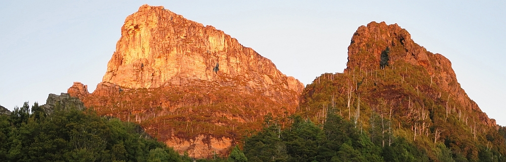
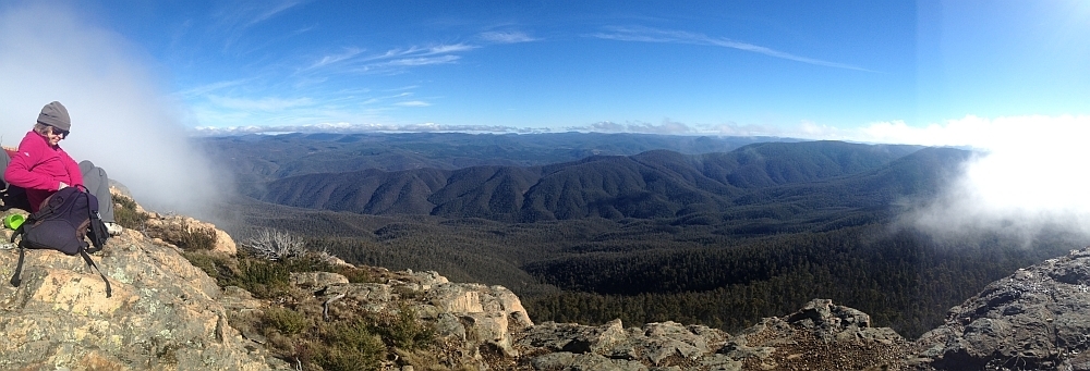
22 Apr 15 | Morning light on Frenchmans Cap and Lions Head, Tasmania
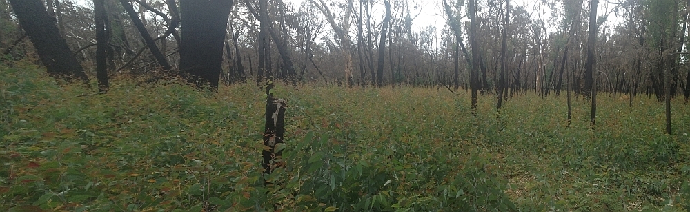
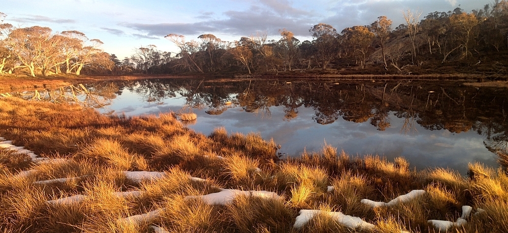
3 Mar 15 | Eucalyptus 'grass', Nadgigomar NR
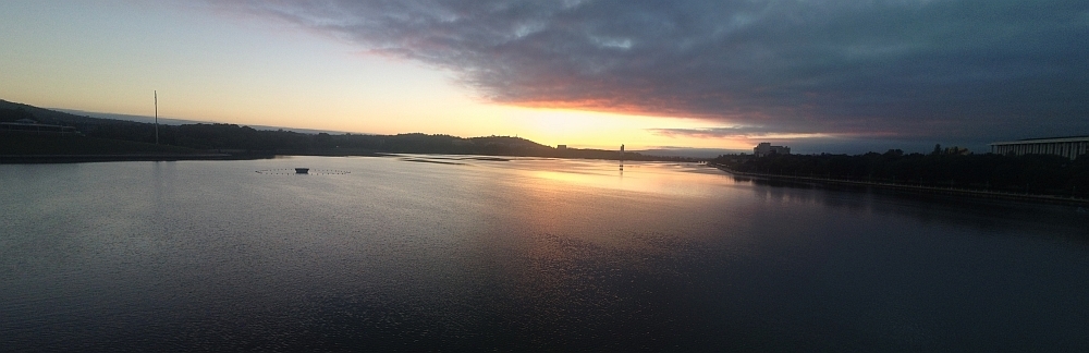
7 Feb 15 | Sunrise over Lake Burley Griffin at 6.30am, Canberra
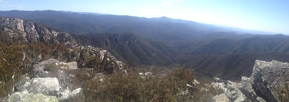
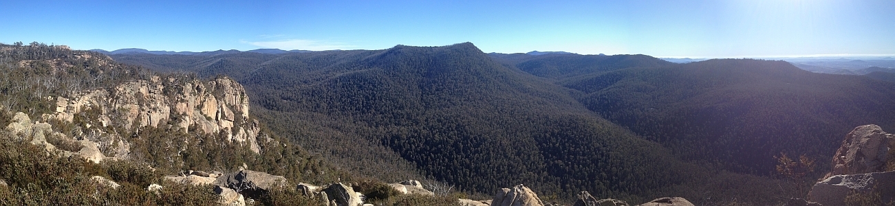
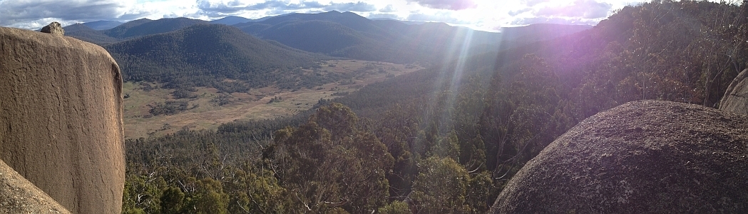
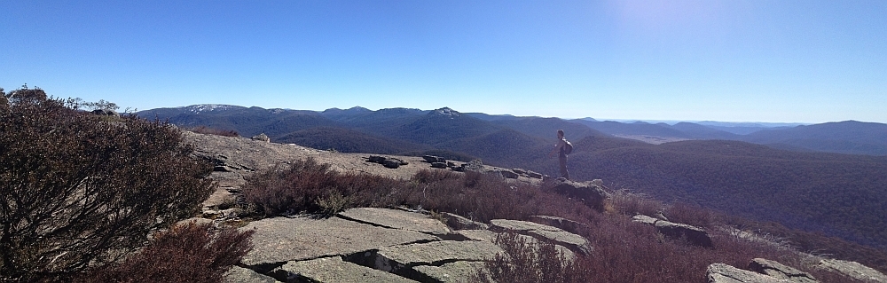
30 Sep 14 | Views down the south arm of Burkes Creek from The Pimple,NNP
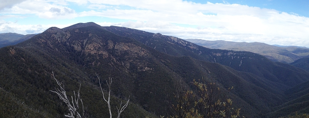
13 Sep 14 | Tidbinbilla Ridge, Mt Eliza and the main tor from Gibraltar Peak,TNR
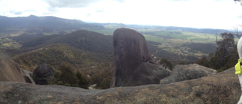
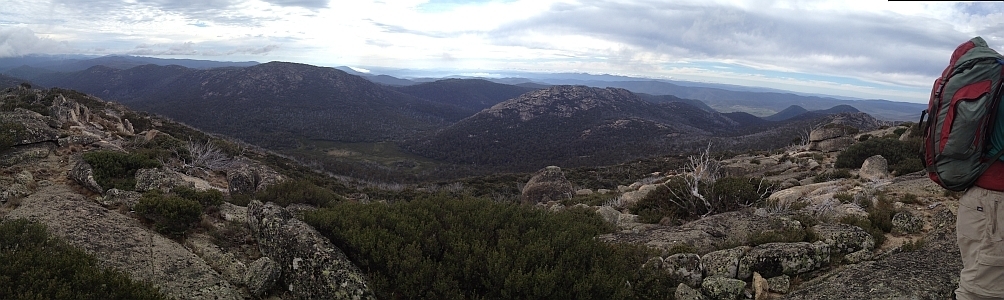
2 Sep 14 | View south to Johns Peak, Tidbinbilla Peak, Tidbinbilla Mountain and The Pimple, TNR and NNP
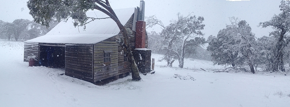
28 Jun 14 | Gooandra Homestead, KNP
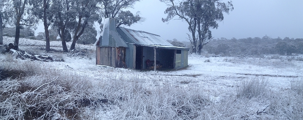
12 Jul 14 | Waterhole Hut, NNP
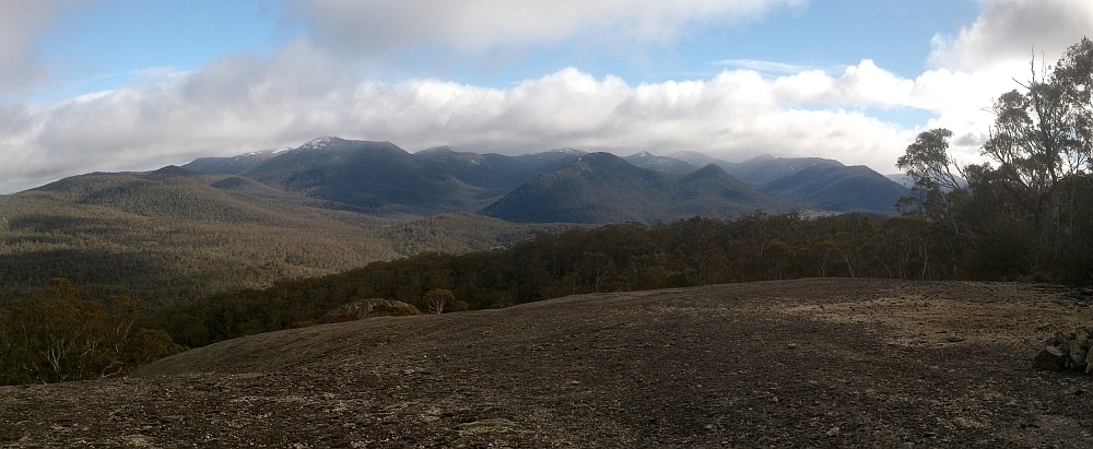
6 Jul 14 | Mt Gudgenby and the high hills of the Namadgi from Boboyan tor lookout, NNP
7 Jun 14 | Blue Gum Hill and the South Buttress of Booroomba Rocks from SH1353, NNP
24 May 14 | Orroral Valley from GC1XAJQ Ridge of Stone geocache, NNP
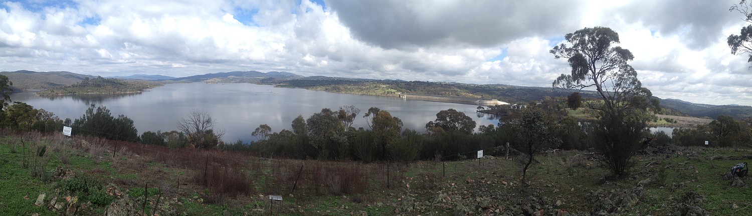
29 Mar 14 | Googong Dam from Googong Lookout, GF
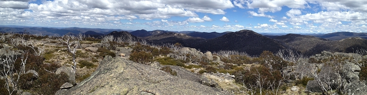
15 Mar 14 | Mt Namadgi, Rotten Swamp, Mt Burbidge, Bogong Gap, Gudgenby Grasslands and Yankee Hats from Mt Kelly, NNP
10 Aug 13 | Plains trig, Pri
13 Jul 13 | Scabby Tarn at sunset, NNP
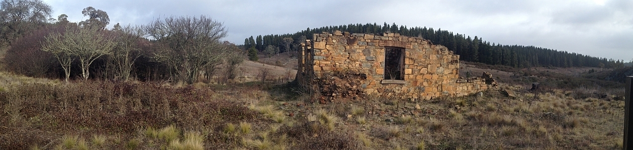
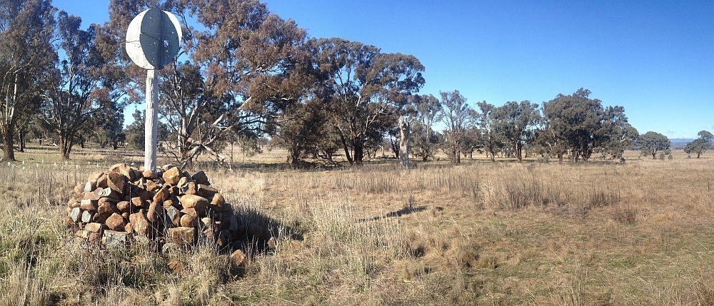
25 Jun 13 | Colliers homestead and orchard, Pri
8 June 13 | Webbs Ridge from Mt Coree, BNP
4 Jun 13 | Mt Moollattoo from the Carrialoo plateau, MNP
9 Sep 12 | Mt Gudgenby from granite slabs E of Sentry Box Mountain, NNP
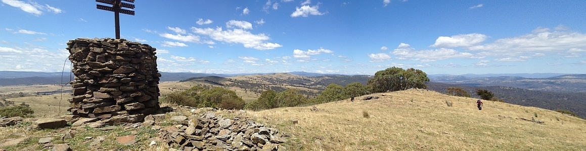
10 Nov 12 | View south from Mt Namadgi, NNP
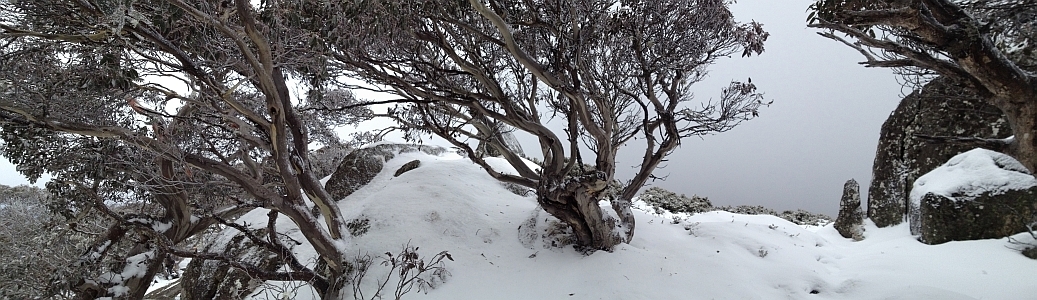
30 Jun 12 | Snow Gums at Mt Gingera, NNP
31 Jan 12 | Molonglo Ridge from Yarrow Pic, Pri
28 Jun 16 | Lunch on Mt Reedy (photo Barrie R), KF
| All | All Trip Destinations and Parking via a Google Map/Google Earth | |||||
| 2016 | 2018-2014 Trip Destinations and Parking via a Google Map | |||||
| 1044 | 10 Dec 16 | NNP: Ginini Falls with geocacher Cankid s* | 10.7 | 685 | M/R; M(11+++) | Photos |
| 1043 | 29 Nov 16 | MoNP: Upper Buckenbowra River |
10.4 | 760 | M/R; H(12) | Photos |
| 1042 | 26 Nov 16 | NNP: Top end of Corin Dam s* |
43.0 | 1130 | L/E,W; H(12) | Photos |
| 1041 | 22 Nov 16 | NNP: Booroomba Rocks via Gorilla Rock |
10.9 | 500 | M/R; H(12) | Photos |
| 1040 | 21 Nov 16 | KNR: Kama NR geocaching ! and CBC evening walk | 9.5 | 220 | S/E; E(4) | Photos |
| 1039 | 21 Nov 16 | MRC: Point Hut Crossing to Kambah Pool ride with Pat |
33.7 | 480 | L/E; M(10) ride | Photos |
| 1038 | 15 Nov 16 | CNP: Red Hill Moon Walk * | 5.2 | 220 | S/E; E(4) | Photos |
| 1037 | 15 Nov 16 | NNP: Forests of Snowy Flat Creek | 14.5 | 1160 | L/R; H(13) | Photos |
| 1036 | 14 Nov 16 | CNP: Red Hill | 5.5 | 250 | S/E; E(4) | Photos |
| 1035 | 6-7 Nov 16 | NNP: Bimberi Peak from Orroral |
51.2 | 2060 | L/E; H(12) | Photos |
| 1034 | 5 Nov 16 | NNP: Mt Gingera |
20.1 | 1160 | L/E-M; H(13) | Photos |
| 1033 | 3 Nov 16 | NNP: Cypress Pine Lookout and the cascades | 4.5 | 100 | S/E; E(4) | Photos |
| 1032 | 2 Nov 16 | NNP: Pipeline Rd ride with Pat ! | 21.9 | 1190 | L/E; H(12) ride | Photos |
| 1031 | 29 Oct 16 | CNP: Red Hill | 10.6 | 365 | M/E; E(7) | Photos |
| 1030 | 26 Oct 16 | NNP: Thunder Bluff |
13.1 | 620 | M/R; H(12) | Photos |
| 1029 | 16-17 Oct 16 | NNP: Bimberi Peak with |
64.0 | 2120 | L/E-M; VH(16) | Photos |
| 1028 | 13 Oct 16 | MNP: Wave Cave via ‘Skinny Woman Pass’ * |
5.6 | 285 | S/R; M(9+) | Photos |
| 1027 | 12 Oct 16 | Pri: Navigation Refresher #7: Use of PC with GPSr * | ||||
| 1026 | 10 Oct 16 | NNP: Mt Tennent Scar * |
12.1 | 760 | M/R; H(12) | Photos |
| 1025 | 8 Oct 16 | NNP: Mt Orroral * |
11.2 | 690 | M/R; M(11) | Photos |
| 1024 | 1 Oct 16 | NNP: Greens Peak (SH1409) | 8.0 | 640 | M/R; M(11+) | Photos |
| 1023 | 24 Sep 16 | NNP: Naas Creek and Sentry Box geocaching * |
38.2 | 1000 | L/R; H(14) | Photos |
| 1022 | 20 Sep 16 | TNR: Tidbinbilla Traverse – Snowy Corner to Fishing Gap |
16.1 | 1040 | L/R; H(14) | Photos |
| 1021 | 13 Sep 16 | NNP/LCC: More Brindabella geocaching ride/walk ! | 27.6 | 600 | L/M,ptX; M(11) | Photos |
| 1020 | 11 Sep 16 | MRC: Murrumbidgee River stroll ! | 10.7 | 120 | M/E,X; E(5) | Photos |
| 1019 | 6 Sep 16 | CC: Back of Cotter Dam geocaching ride and walk |
24.5 | 720 | L/M; H(12) ride | Photos |
| 1018 | 3 Sep 16 | CNP: Mulligans Flat Nature Reserve | 9.8 | 140 | S/E; E(5) | Photos |
| 1017 | 30 Aug 16 | NNP: Brandy Flat geocaching ! | 14.2 | 490 | M/M; M(10) ride | Photos |
| 1016 | 27 Aug 16 | NNP: Potters Hill wander * | 9.2 | 380 | M/M,ptX;M(8) | Photos |
| 1015 | 22 Aug 16 | NNP: Booroomba’s Southern Butt and Deadmans Hill s* |
12.6 | 710 | M/R,ptX; H(12) | Photos |
| 1014 | 16 Aug 16 | CNP: Night Walk on Black Mountain | 5.2 | 265 | S/E; E(5) | Photos |
| 1013 | 16 Aug 16 | ACTF/NNP: Blue Ridge geocaching |
15.8 | 980 | L/M: H(13) | Photos |
| 1012 | 13 Aug 16 | TNR: Mt Domain |
12.9 | 675 | M/R; M(11) | Photos |
| 1011 | 10 Aug 16 | YNR: Queanbeyan River and Spring Creek Gorge |
10.6 | 380 | M/M-R; M(10) | Photos |
| 1010 | 4 Aug 16 | NNP: (A walk for Lindsay) Head butting at Booroomba s* |
9.7 | 500 | M/R,ptX; M(11) | Photos |
| 1009 | 2 Aug 16 | NaNP: (Near) Bonum Pic | 14.4 | 300 | M/M; M(10) | Photos |
| 1008 | 30 Jul 16 | NNP: Geocaches above the Cotter Hut Rd s* (aka ‘Wretched Ridge’) |
24.0 | 780 | L/E&R,ptX; H(14) | Photos |
| 1007 | 26 Jul 16 | NNP: Spinnaker Rock |
7.6 | 430 | S/M; M(10) | Photos |
| 1006 | 19 Jul 16 | MNP: Headwaters of Ettrema Creek |
8.7 | 150 | S/R; M(9+) | Photos |
| 1005 | 16 Jul 16 | TNR: Mt Domain |
13.2 | 830 | L/R; H(12) | Photos |
| 1004 | 14 Jul 16 | NNP: Mt Tennent and Bushfold Flats ! | 19.7 | 950 | L/E; M(11) | Photos |
| 1003 | 9-10 Jul 16 | NNP: Sub 24 hour camping #5: Pryors Hut and Mt Gingera |
24.5 | 1350 | M/M; M(10) | Photos |
| 1002 | 2 Jul 16 | CNP/CCT: Northern Geocaching ! | 34.0 | 500 | L/E; M(11) ride | Photos |
| 1001 | 28 Jun 16 | KPF: Creeks of Kowen Forest | 8.5 | 305 | S/R; M(9) | Photos |
| 1000 | 25 Jun 16 | NNP: A Weir-d day in the Brindabellas *s |
18.5 | 850 | L/E-M; H(12) | Photos |
| 999 | 13 Jun 16 | CNP: Geocaching off-track in the deep south (suburbs) of the ACT ! | 2.9 | 250 | S/M,X; E(6) | Photos |
| 998 | 8 Jun 16 | TSF: Mt Minor from the west |
5.8 | 360 | S/R; M(9) | Photos |
| 997 | 24 May 16 | NNP: Mt Tennent scar again ! |
13.6 | 950 | L/E,R; H(12) | Photos |
| 996 | 17 May 16 | NNP: Tennent geocaching | 7.0 | 435 | M/R; M(10) | Photos |
| 995 | 14 May 16 | NNP: Billy Billy Rocks from Fishing Gap fire trail |
8.9 | 650 | M/R; M(11) | Photos |
| 994 | 11 May 16 | BNP: Wave Cave and beyond |
6.1 | 315 | S/R; M(10) | Photos |
| 993 | 6 May 16 | CNP: Mt Ainslie Quarry ! |
2.1 | 180 | S/M,X; E(6) | Photos |
| 992 | 19 Apr 16 | KSCA: Mt Pleasant and Kybeyan River gorge | 11.2 | 560 | M/R; M(10) | Photos |
| 991 | 16 Apr 16 | NNP: Split Rock * |
23.1 | 750 | L/E&R; H(12) | Photos |
| 990 | 13 Apr 16 | NNP: Geocaching McKeahnie in the Middle |
15.4 | 645 | L/R; H(12+) | Photos |
| 989 | 12 Apr 16 | TiNR: The Onion and Tinderry granite |
14.0 | 585 | L/R; H(12) | Photos |
| 988 | 5 Apr 16 | ACTF: Two Sticks Hill and Mt Dowling | 21.3 | 890 | L/E&R; H(13) | Photos |
| 987 | 3 Apr 16 | NNP: Mt Gudgenby |
16.8 | 880 | L/R; H(14) | Photos |
| 986 | 28 Mar 16 | TNR: Mt Domain | 12.3 | 700 | M/R; H(13) | Photos |
| 985 | 26 Mar 16 | NNP: Middle Creek | 20.0 | 530 | L/E-R; M(11) | Photos |
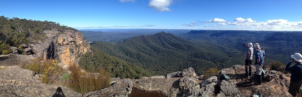
| 984 | 22 Mar 16 | BMNP: Parliament Hill, Blue Mountains National Park |
17.3 | 860 | L/R; H(13) | Photos |
| 983 | 16 Mar 16 | TNR: Mt Domain * | 12.5 | 700 | M/R; H(13) | Photos |
| 982 | 12 Mar 16 | CNP: Rob Roy via the gully | 11.5 | 585 | M/R; M(11) | Photos |
| 981 | 5-6 Mar 16 | CNP/CCT/Urban: Cbr100Challenge 100km route for Beryl Women’s Shelter * | 101.7 | 2095 | L/E; H(13++) | Photos |
| 980 | 1 Mar 16 | TNR: Camels Hump and beyond | 18.6 | 965 | L/E-M; H(13-) | Photos |
| 979 | 27 Feb 16 | CCT: Night Walking on the northern Canberra Centenary Trail *s | 19.8 | 465 | L/E; M(8+) | Photos |
| 978 | 23 Feb 16 | CNP/CCT: Majura Stone Walls and the Cbr100 route *s | 21.9 | 735 | L/E; M(11) | Photos |
| 977 | 20 Feb 16 | CNP/CCT: Cbr100 Training Gold Creek to Watson | 39.3 | 770 | L/E; M(11+) | Photos |
| 976 | 16 Feb 16 | NNP: Ridge West of Bushfold Flats |
13.2 | 700 | L/R; H(12) | Photos |
| 975 | 13 Feb 16 | NNP: Mt Coree |
19.2 | 825 | L/E; M(11) | Photos |
| 974 | 8-10 Feb 16 | KNP: Kidmans Hut and the Great Dividing Range |
46.8 | 1395 | L/R,X; H(12) | Photos |
| 973 | 6 Feb 16 | TNR: Gibraltar Peak | 7.3 | 370 | S/E; E(6) | Photos |
| 972 | 2 Feb 16 | NNP: More Headwaters of Honeysuckle Creek |
13.7 | 625 | M/R; H(12) | Photos |
| 971 | 31 Jan 16 | Presentation to Artists Society of Canberra – A brush with the Border ! | Photos | |||
| 970 | 30 Jan 16 | Urban/CCT: Cbr100 Training for Beryl Womens Shelter ! | 46.6 | 860 | L/E; M(11+) | Photos |
| 969 | 28 Jan 16 | TNR: Chinese tour group to Tidbinbilla Nature Reserve ! | 4.7 | 180 | S/E; E(4) | Photos |
| 968 1,2,3,4 | 26 Jan 16 | NNP/Rural: Orroral Adventures |
17.5 | 870 | L/E,M,R,ptX; H(13) | Photos |
| 967 | 23 Jan 16 | Urban: Lap of Lake Burley Griffin *s | 30.8 | 150 | L/E; M(8) | Photos |
| 966 | 21 Jan 16 | CNP: Aranda Bushland, Kiers Trig and Frost Hollow | 5.6 | 140 | S/E; E(4) | Photos |
| 965 | 17 Jan 16 | NNP: High Range and near SH1409 |
12.2 | 580 | M/R; H(12) | Photos |
| 964 | 16 Jan 16 | NNP: Blatant Brindabella Geocaching *s | 18.6 | 920 | L/E,M,R; H(13-) | Photos |
| 963 | 12 Jan 16 | MRC/CCT: Murrumbidgee Walking Track (CCT) from Pine Island to Kambah Pool and return ! | 22.0 | 540 | L/E-M; M(11+) | Photos |
| 962 | 11 Jan 16 | CNP: Farrer Ridge and Wanniassa Hills NRs | 7.7 | 340 | S/E; E(7) | Photos |
| 961 | 9 Jan 16 | NNP: Cbr100 training – Mt Tennent *s | 15.6 | 890 | L/E; M(9) | Photos |
| 960 | 8 Jan 16 | MNP: Bainbrig Creek and Wave Cave |
9.9 | 365 | M/R,X; M(10) | Photos |
| 959 | 2 Jan 16 | Urban: Cbr100 training – 25km route *s | 29.9 | 720 | L/E; H(12-) | Photos |