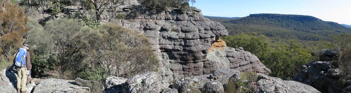
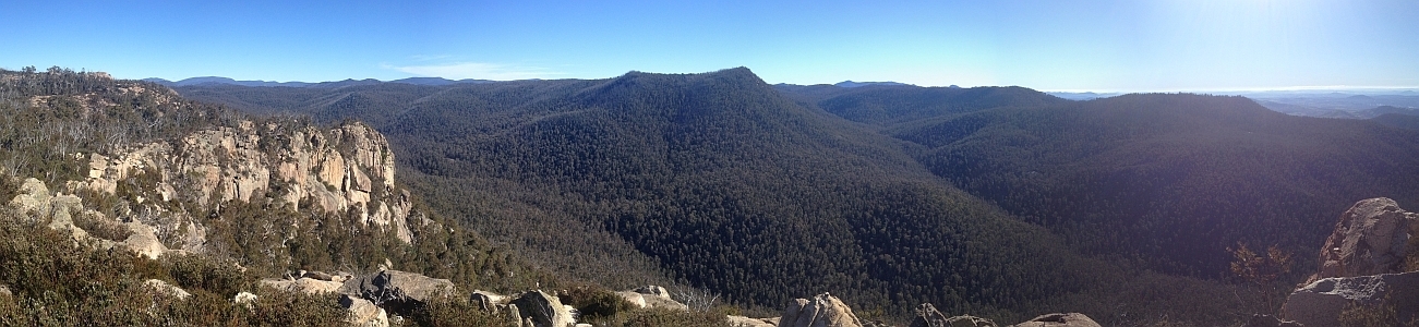
28 Jun 15 | The top of Binnari Pass to Quiltys Mountain, the Budawangs, Morton NP
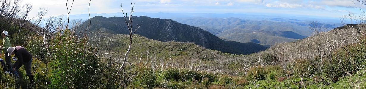
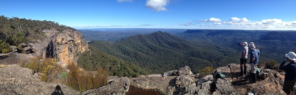
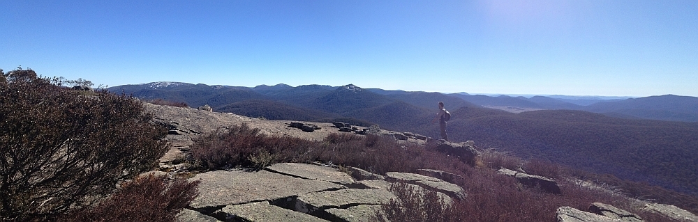
30Jun 15 | Views from north of Currockbilly Mountain over the source of the Yadboro River to Wirritin Basin and beyond to Pigeon House and the ocean, Budawang NP
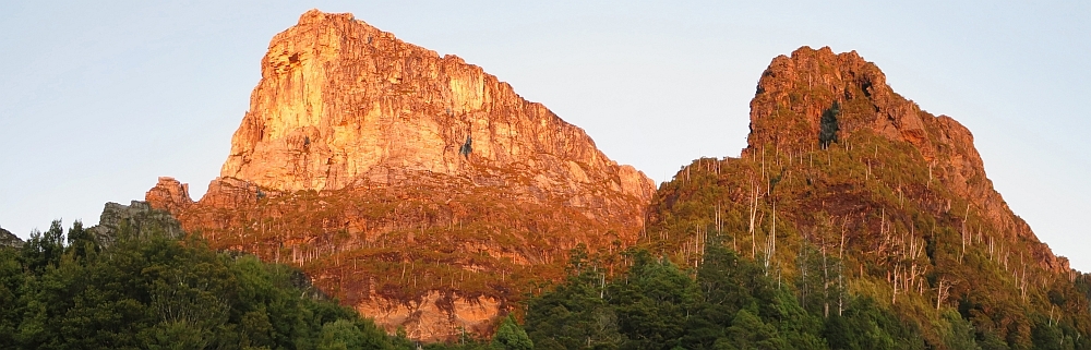
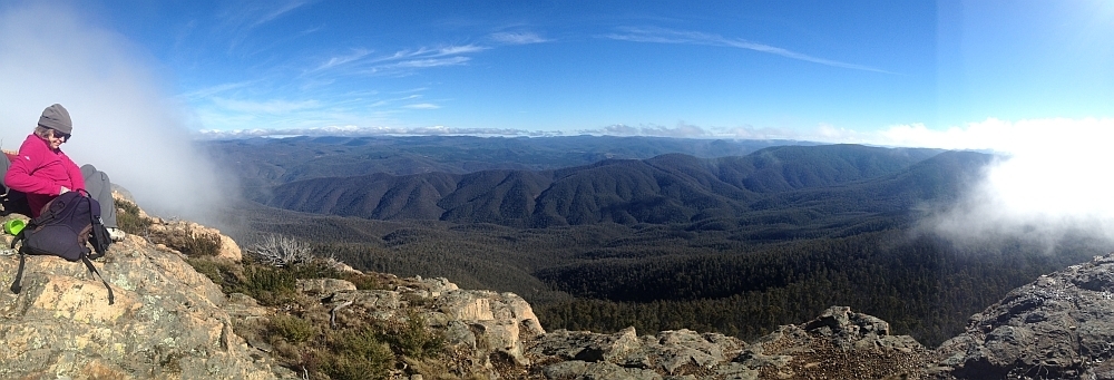
22 Apr 15 | Morning light on Frenchmans Cap and Lions Head, Tasmania
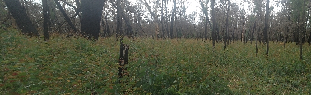
3 Mar 15 | Eucalyptus 'grass', Nadgigomar NR
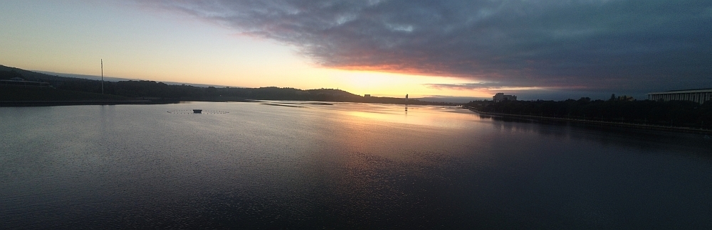
7 Feb 15 | Sunrise over Lake Burley Griffin at 6.30am, Canberra
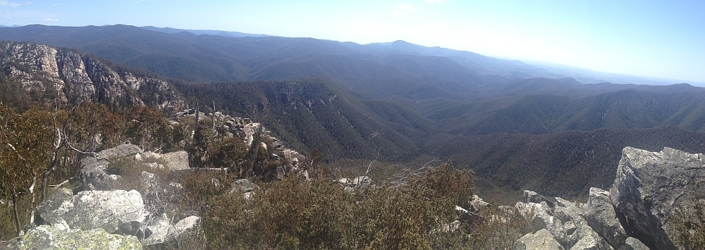
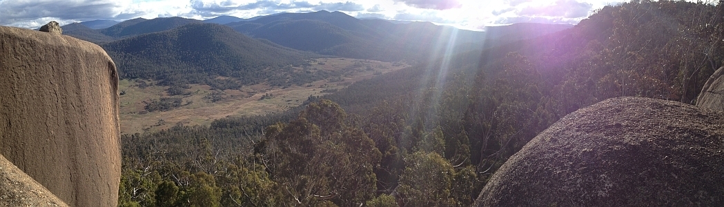
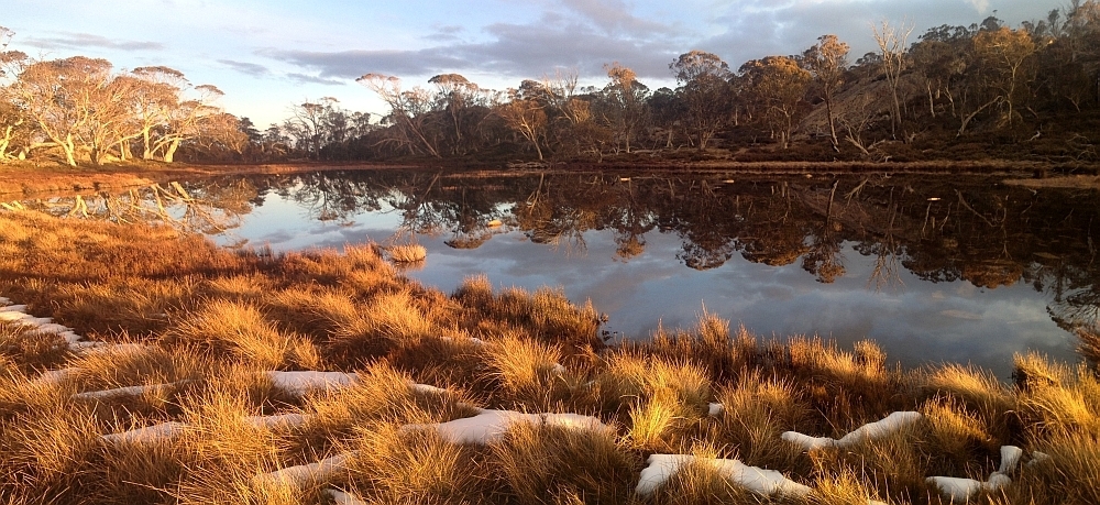
30 Sep 14 | Views down the south arm of Burkes Creek from The Pimple,NNP
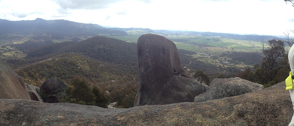
13 Sep 14 | Tidbinbilla Ridge, Mt Eliza and the main tor from Gibraltar Peak,TNR
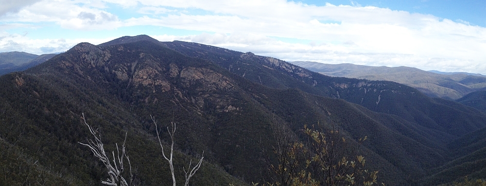
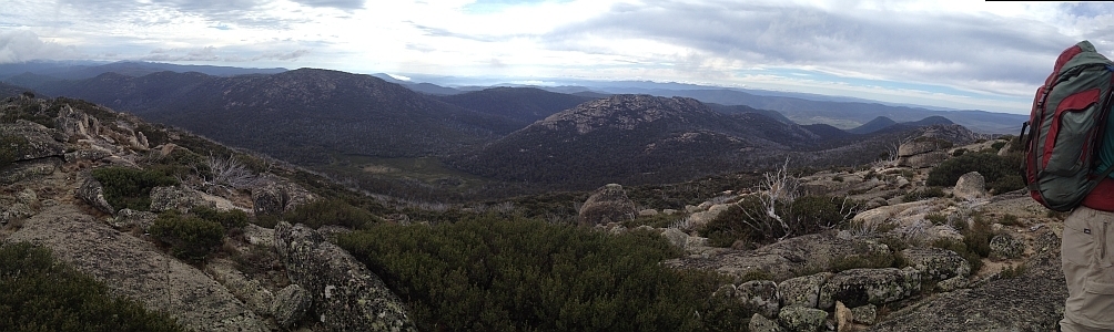
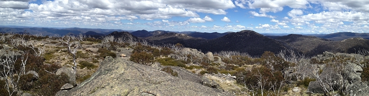
2 Sep 14 | View south to Johns Peak, Tidbinbilla Peak, Tidbinbilla Mountain and The Pimple, TNR and NNP
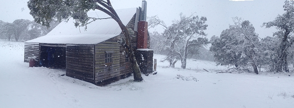
28 Jun 14 | Gooandra Homestead, KNP
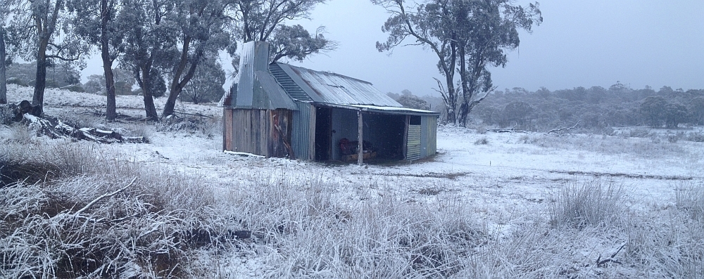
12 Jul 14 | Waterhole Hut, NNP
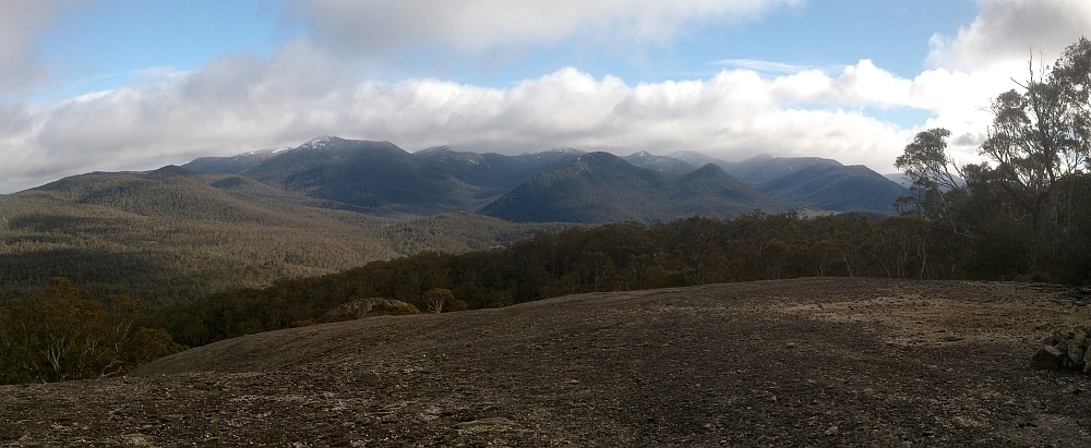
6 Jul 14 | Mt Gudgenby and the high hills of the Namadgi from Boboyan tor lookout, NNP
7 Jun 14 | Blue Gum Hill and the South Buttress of Booroomba Rocks from SH1353, NNP
24 May 14 | Orroral Valley from GC1XAJQ Ridge of Stone geocache, NNP
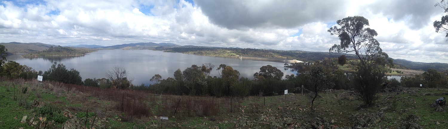
29 Mar 14 | Googong Dam from Googong Lookout, GF
15 Mar 14 | Mt Namadgi, Rotten Swamp, Mt Burbidge, Bogong Gap, Gudgenby Grasslands and Yankee Hats from Mt Kelly, NNP
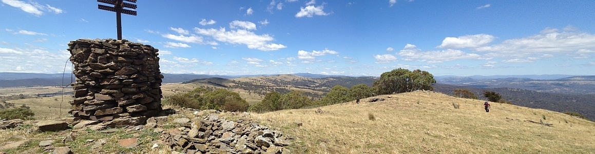
10 Aug 13 | Plains trig, Pri
13 Jul 13 | Scabby Tarn at sunset, NNP
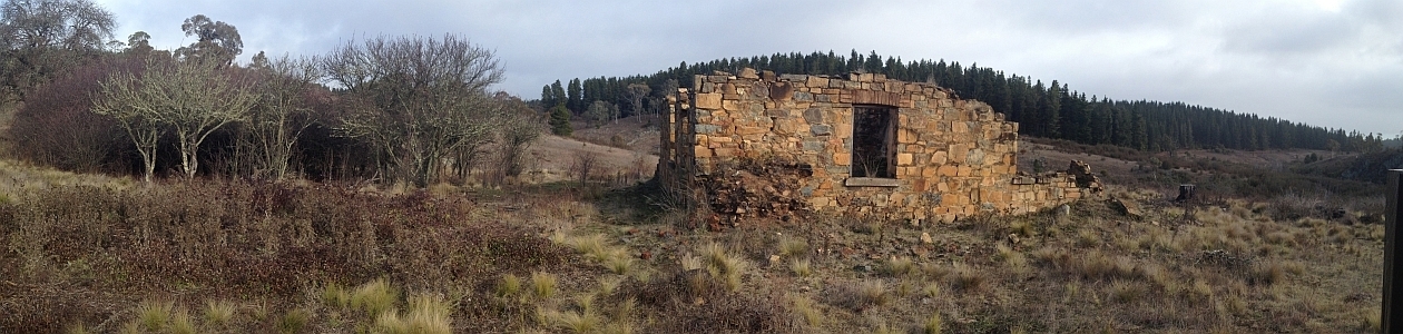
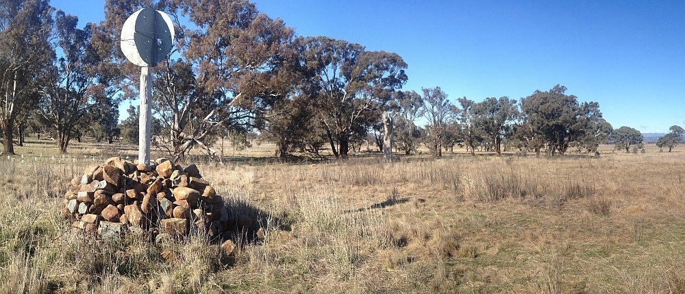
25 Jun 13 | Colliers homestead and orchard, Pri
8 June 13 | Webbs Ridge from Mt Coree, BNP
4 Jun 13 | Mt Moollattoo from the Carrialoo plateau, MNP
9 Sep 12 | Mt Gudgenby from granite slabs E of Sentry Box Mountain, NNP
10 Nov 12 | View south from Mt Namadgi, NNP
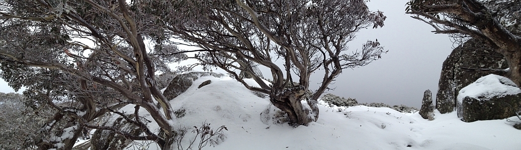
30 Jun 12 | Snow Gums at Mt Gingera, NNP
31 Jan 12 | Molonglo Ridge from Yarrow Pic, Pri
28 Jun 16 | Lunch on Mt Reedy (photo Barrie R), KF
| All | All Trip Destinations and Parking via a Google Map/Google Earth | |||||
| 2017 | 2018-2014 Trip Destinations and Parking via a Google Map | |||||
| 1128 | 31 Dec 17 | CNP: Evening ramble – Wanniassa Hills | 4.3 | 180 | S/E; E(5) | |
| 1127 | 16 Dec 17 | ACTF/NNP: Bulls Head Range, Brindabellas * |
17.5 | 700 | L/E-M; M(11) | Photos |
| 1126 1,2 | 4, 5-10 Dec 17 | KNP: Thredbo to Kiandra on the AAWT | 114.8 | 3185 | M-L/M; M(10++) | Photos Photos |
| 1125 | 23 Nov 17 | NNP: Long time walkabout to Cotter Hut * |
36.3 | 1100 | L/E; H(12) | Photos |
| 1124 | 22 Nov 17 | CNP: Southside Stroll in daylight savings – Theodore knolls and aboriginal grinding grooves * |
6.4 | 270 | S/E-M,ptX; E(7) | Photos |
| 1123 | 21 Nov 17 | NNP: Billy Billy Rocks from the east |
6.2 | 500 | S/M-R,ptX: M(10) | Photos |
| 1122 1,2 | 19 Nov 17 | NNP: Corin caching – again ! | 7.3 | 400 | S/M,ptX; M(8) | Photos |
| 1121 | 15 Nov 17 | Pri: Visit ‘the trig which cannot be named’ |
20m | 1 | S/E,X; VE(¼) | Photos |
| 1120 | 10-12 Nov 17 | NNP: Corin Cottage weekend |
32.1 | 2215 | S,M-L/E-R; M(11) | Photos |
| 1119 | 7 Nov 17 | NNP: White Horse Rocks and Punch Bowl Creek |
8.8 | 490 | M/R; M(9) | Photos |
| 1118 | 6 Nov 17 | CNP: Southside Stroll in daylight savings – MacArthur Park * | 7.0 | 220 | S/E-M; E(6) | Photos |
| 1117 | 2 Nov 17 | H&HWT: Micalong Creek |
11.7 | 370 | M/E; E(7) | Photos |
| 1116 | 31 Oct 17 | NNP: Mt Mouat |
18.6 | 900 | L/R; H(14+) | Photos |
| 1115 | 28-29 Oct 17 | NNP: Split Rock and Coronet Peak |
32.9 | 1550 | L/E,R; H(13) | Photos |
| 1114 | 26 Oct 17 | Pri: Navigation refresher #7 GPS and PC software * |
||||
| 1113 | 25 Oct 17 | CbrOpenSpace: Southside Stroll in daylight savings – A Lap of Lake Tuggeranong | 5.7 | 30 | S/E; VE(3) | |
| 1112 | 20-21 Oct 17 | CCT/MFNR: Long time and night walkabout – Hall to Forde, critter spotting , Forde to Hall * |
43.6 | 1050 | L/E-M; H(12) | Photos |
| 1111 | 19 Oct 17 | GNR: Southside Stroll in daylight savings – De Salis cemetery and Gudgenby-Murrumbidgee Rivers | 3.6 | 38! | S/E; E(4) | Photos |
| 1110 | 17 Oct 17 | TNR: 11 hours on the TNR Skyline ‘Track’ |
21.4 | 1260 | L/R; VH(15) | Photos |
| 1109 | 14 Oct 17 | NNP: Worn Boot Bash to Mt Clear * | 28.0 | 995 | L/E-M; H(14) | Photos |
| 1108 | 12 Oct 17 | Pri: (Geocaching and) Southside Stroll in daylight savings – William Farrer’s grave * | 1.6 | 40 | S/E-M; VE(3) | Photos |
| 1107 | 10 Oct 17 | Crown land: Shoalhaven River rock ribs | 11 | 200 | M/R,W; M(10+) | Photos |
| 1106 | 7 Oct 17 | NNP: ‘Ginger Ale’ | 31.0 | 1260 | L/M: H(14) | Photos |
| 1105 | 29-30 Sep 17 | NNP: Dutchies Peak, Mt McKeahnie and beyond |
32.2 | 1240 | L/R; H(14) | Photos |
| 1104 | 26 Sep 17 | KNP: Chimney Rock above Blowering Cliffs and Blowering Cliffs Walk *s |
11.4 | 920 | L/M; H(12) | Photos |
| 1103 | 23-24 Sep 17 | NNP: Mountain bike riding in the Southern Namadgi | 42.5 | 890 | M/M; M(11) | Photos |
| 1102 | 20 Sep 17 | CP: 8am Floriade walk | ~1 | – | S/E | Photos |
| 1101 | 19 Sep 17 | NNP: Mt Gudgenby and beyond |
17.4 | 920 | L/R; H(14) | Photos |
| 1100 | 17 Sep 17 | NNP: Mt Tennent sunset and Bushfold Flats | 20.3 | 1050 | L/E; H(12) | Photos |
| 1099 | 5 Sep 17 | TNR/ACTF: Nil Desperandum and beyond | 20.9 | 670 | L/E-M; M(10) | Photos |
| 1098 | 29 Aug 17 | NNP: Boboyan Trig from Hospital Creek Hut * | 15.5 | 615 | L/R: M(11) | Photos |
| 1097 | 26 Aug 17 | NNP: McKeahnie Trig *s | 13.6 | 540 | M/R; H(12) | Photos |
| 1096 1,2 | 24 Aug 17 | NNP: Corin Road caches ! | 5.1 | 455 | S/R,X; M(9+) | Photos |
| 1095 | 22 Aug 17 | SCNR: Swamp Creek exploratory |
6.1 | 250 | S/R; M(9++) | Photos |
| 1094 | 19 Aug 17 | TNR: Gibraltar geocaching ! | 12.0 | 675 | M/E,R,ptX; M(10) | Photos |
| 1093-1,2 | 15 Aug 17 | NNP: Orroral Ridge of Stone revisited and the ‘Forgotten Road’ * | 13.3 | 510 | M,M-R: M(11) | Photos |
| 1092 | 8 Aug 17 | TRNP: Tarlo River |
14.6 | 500 | M/R; M(11) | Photos |
| 1091 | 5 Aug 17 | NNP: Booths Hill |
10.1 | 810 | M/R; H(12) | Photos |
| 1090 | 29 Jul 17 | RRNR: Callaghan Hill * | 12.1 | 795 | M/M,ptX; M(11) | Photos |
| 1089 | 25 Jul 17 | RRNR: Three Creeks of Rob Roy |
9.6 | 525 | M/R; M(11) | Photos |
| 1088 | 22 Jul 17 | Urban: Burley Griffin Ramble Part 2 | 21.1 | – | L/E; E(7+) | Photos |
| 1087 | 15 Jul 17 | NNP/BNP/ACTF: Mt Coree and nearby geocaching * | 19.7 | 980 | L/E; H(12) | Photos |
| 1086 | 11 Jul 17 | NNP: Orroral Ridge of Stone loop |
12.8 | 660 | M/R,ptX; H(12) | Photos |
| 1085 | 8 Jul 17 | TNR: Tidbinbilla (T)romp * | 6.4 | 445 | S/E-M; M(9) | Photos |
| 1084 | 1 Jul 17 | NNP: Hardy Range geocaching * |
12.8 | 800 | M/M-R; H(13) | Photos |
| 1083 | 28 Jun 17 | TNR: Tidbinbilla Nature Reserve Skyline Track, middle and northern sections ! | 13.6 | 900 | L/R; H(13) | Photos |
| 1082 | 24 Jun 17 | TNR: Tidbinbilla Peak via the northern Skyline Track * | 13.8 | 900 | L/M-R; H(13) | Photos |
| 1081 | 22 Jun 17 | NNP: Apollo Rocks and other places |
2.6 | 345 | S/R; M(9++) | Photos |
| 1080 | 21 Jun 17 | NNP: Mt Tennent Scar |
10.9 | 800 | M/R; H(12) | Photos |
| 1079 | 17 Jun 17 | NNP: Nursery Swamp and Rendezvous Creek * | 17.1 | 450 | L/E-M; M(10) | Photos |
| 1078 | 14 Jun 17 | NNP: Mt Gingera from Corin Dam | 20.0 | 1160 | L/E-M; H(13) | Photos |
| 1077 | 8 Jun 17 | NNP: Corin Caching ! | 8.0 | 395 | M/M; M(8) | Photos |
| 1076 | 6 Jun 17 | NNR: Nadgigomar Nature Reserve | 19.0 | 150 | L/M; M(9) | Photos |
| 1075 | 3 Jun 17 | NNP: High Hills East of Gibraltar Creek | 6.2 | 425 | S/R; M(10) | Photos |
| 1074 | 30 May 17 | MNP: Coolumburra Cliffs |
7.5 | 350 | S/R; M(10++) | Photos |
| 1073 | 27 May 17 | TNR: Tidbinbilla Mountain and Tidbinbilla Peak |
9.6 | 780 | M/R; M(11) | Photos |
| 1072 | 23 May 17 | MNP: Caoura Ridge |
19.4 | 575 | L/M-R; H(12) | Photos |
| 1071 | 21 May 17 | CNP: Big Monks *s | 5.9 | 375 | S/E; E(7) | Photos |
| 1070 | 13 May 17 | BNR: Honeysuckle Trail to Brindabella Valley and Bendora Hill *s | 19.6 | 1010 | L/E,ptX; H(12-) | Photos |
| 1069 | 7-8 May 17 | TNR: Conservation Volunteers at Tidbinbilla Nature Reserve |
10 | 400 | S/E; E(5) | Photos |
| 1068 | 22 Apr 17 | NNP: Warking in the Brindabellas *s |
18.4 | 400 | L/E-M; M(10) | Photos |
| 1067 | 15-17 Apr 17 | NNP: Mt Namadgi and Squirrel geocaching |
34.1 | 1150 | M/R,ptX; M(11++) | Photos |
| 1066 | 12 Apr 17 | NNP: Orca Rock and geocaching |
15.2 | 670 | L/R; H(12) | Photos |
| 1065 | 8 Apr 17 | NNP: Geocaches on Coronet Peak *s |
19.0 + 11.4 |
1320 | L/R,ptX; H(14) | Photos |
| 1064 | 14 Mar 17 | NNP: Blue Gum Hill |
15.6 | 750 | L/R; H(13) | Photos |
| 1063 | 7 Mar 17 | Tasmania: Mt Field – Tarn Shelf Circuit |
15.5 | 600 | M/M; M(10) | Photos |
| 1062 | 6 Mar 17 | Tasmania: Mt Field West |
19.0 | 850 | L/R; H(12) | Photos |
| 1061 1060 |
5 Mar 17 | Tasmania: Mt Field – Lady Barron Falls Circuit and Lake Seal Lookout |
5.9 6.7 |
S/E; E(7) S/E; E(6) |
Photos | |
| 1059 | 4 Mar 17 | Tasmania: Cape Raoul |
15.8 | M/M; M(10) | Photos | |
| 1058 | 28Feb-3Mar 17 | Tasmania: Three Capes Walk |
45.7 + 20.5 |
S-M/M; M(9) | Photos | |
| 1057 | 21 Feb 17 | PSF: The secrets of Penrose State Forest |
21.2 | 480 | L/R; H(12) | Photos |
| 1056 | 14 Feb 17 | GNR: Gigerline trig geocaching | 8.3 | 300 | S/M; M(8) | Photos |
| 1055 | 10-12 Feb 17 | KNP: Mt Jagungal from Cesjacks Hut |
24.4 | 800 | M/R; M(11) | Photos |
| 1054 | 7 Feb 17 | CuNR: Cuumbeun Nature Reserve | 18.6 | 640 | L/M; M(11) | Photos |
| 1053 | 4 Feb 17 | Public/MRC/BRNR: Caching on the west bank (that’s geo and ‘bidgee) with OSM |
19.2 | 300 | M (ride) | Photos |
| 1052 | 3 Feb 17 | Road: Tharwa Engineered Log Jam ! | 23 | 290 | E (ride) | Photos |
| 1051 | 31 Jan 17 | NNP: Mt Tennent (with Rudy) s* |
14.1 | 830 | L/E; M(9) | Photos |
| 1050 | 23 Jan17 | BNR: Calvary caching ! | 32.1 | 590 | L/E; M(8) | Photos |
| 1049 | 21 Jan 17 | NNP: Orroral Tor |
10.9 | 450 | M/M-R; M(10) | Photos |
| 1048 | (13)14-15 Jan 17 | KNP: Tabletop Mountain and nearby huts and diggings |
32.5 | 950 | M/M; M(10) | Photos |
| 1047 | 10 Jan 17 | NNP: McKeahnie Trig and nearby granite from Kangaroo Creek |
7.4 | 530 | M/R; M(11+) | Photos |
| 1046 | 3 Jan 17 | NNP: The compleat Booroomba Rocks – cliff, top and butt(ress) |
5.6 | 400 | S/M; M(9) | Photos |
| 1045 | 2 Jan 17 | GNR: De Salis Cemetery * | 3.0 | flat | S/E; VE(3) | Photos |