Saturday 12 July: Long-time Walkabout – L/M. Something for everyone: southern Namadgi views; indigenous and European sites; border markers and blaze trees; up to 12 hours walking; night walking under a full moon to bay at. From the Yankee Hat car park, insert via fire trail and footpad to the south-east Gudgenby saddle, then through some regrowth down to join the Sams Creek Fire Trail. Easy walking down the Naas Creek valley to Lutons crutching shed. Exit over the Naas Creek ford and north along the Old Boboyan Road. 26km and 660m climb – led by Cynthia C. From the fire trail junction near Lutons, the walk can be extended around the Grassy Creek and Bulls Flat Fire Trails. This makes the day 34km and 820m climb. The full walk is extended to include the Grassy Creek Fire Trail to Waterhole Hut and return via Waterhole and Bulls Flat Fire Trails. A day of 40km and 950m. An additional so-leader required if a sub-group wants to do the 34km circuit. Map: Yaouk. Leaders: John Evans – john@johnevans.id.au, 0417 436 877 and Cynthia C. Transport: ∼$15 per person. Further details at www.johnevans.id.au.
Track Map
Planned trip options:

26km

34km
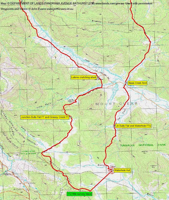
40km
Return to current index | Return to prototype WordPress index