
Restaurant views
Wednesday 9 October 2024: A snowshoe/walk from Charlotte Pass. A marvellous last-minute invitation to join an NPA ACT trip.
Summary
From Garmin Connect (recorded on Epix Gen 2) – Distance: 9.23km | Climb: 390vm | Time: 2:46 moving + 2:09 of stops = 4:55 | Grading: M/M; M(8).
Photographs
View photographs here. Heaps more photos, including a million of Snow Gums.
gpx file
Download the gpx file here.
Track Maps
Here’s where we went.

Track SE of Charlotte Pass
Trip Report
Drive from Calwell to Charlotte Pass took around 2:30. We went to the lookout to check out the snow cover on the Main Range.

Looking E to the Main Range from Charlotte Pass 9Oct24
The initial plan was to cross the Snowy River, walk/snowshoe up to Carruthers Peak and return via Blue Lake. The snow cover looked patchy and probably called for shoes on/off many times, so plan B.
We drove down to Charlotte Pass village, deserted at this time of the year, left a few kg of snowshoes on the car and started walking just after 9.30am.

Leaving a deserted Charlotte Pass village
Heading SE we crossed the first of many delightful streams.

Crossing a small creek just out of Charlotte Pass village
We began a beautiful ascent through Snow Gum woodland, taking our time and many photos.

Snow Gum
A footpad guided us in places, as shown on the TopoView2006 map segment above.
At about the 1920m contour we broke out of the trees.

Main Range from top of Snow Gum area
Lovely country.
Climbing higher towards a saddle, the footpad became clearer.

Clear footpad E of Mt Stilwell
At the crest, we had a clear view along the alignment of the ‘longest chairlift in the world’ to the restaurant site.

At the saddle between Mt Stilwell and 2000+m feature
A sad end to a visionary plan. Read all about it here.
Walking the alignment, there were many remains of the ‘longest chairlift in the world’.

Cable and Meuller tower remains of the longest chairlift in the world
And also lovely natural features.

Snow drifts and tarns
Tiny wildflowers in the damp areas, Psychrophila introloba (Alpine Marsh-marigold). They grow in seeps and swamps, usually near flowing water or snowmelt, above the treeline.

Flowers
As well as the chairlift Meuller towers, there were a number of Switch Stations.

One of the 4 Switch Stations
Crossing Wrights Creek was either by metal bridge …

Chairlift debris makes a bridge over Wrights Creek
… or more naturally.

Mike crossing Wrights Creek
Beautiful country.

Pristine feeder to Wrights Creek untouched by feral horses
A few wildflowers.

Alpine Buttercup (Ranunculus alpestris)
We made it to the restaurant site for a good look around and smoko.

Restaurant views
Turning east after the break, a snow drift provided opportunity for different styles of descent.

The quickest way down
The flora continued to attract our attention.

A sea of colour
Our first crossing of Trapyard Creek was via snow bridge,

Snow bridge over Trapyard Creek
A low saddle took us to another Snow Gum and grass area.

Snow Gum
At 12.40pm we joined the Perisher to Charlotte Pass walking track. new country for me.

Join Charlotte Pass Village to Perisher Valley walk
Time for lunch and a look about.

Mountain grasshopper
Great track work.

Charlotte Pass Village to Perisher Valley walk
The track passes through the edge of the tree line above Johnnies Plan. Trapyard Creek tumbles down.

Trapyard Creek upstream of the bridge
A bridge.
A second tumbling creek was crossed by metal bridge.
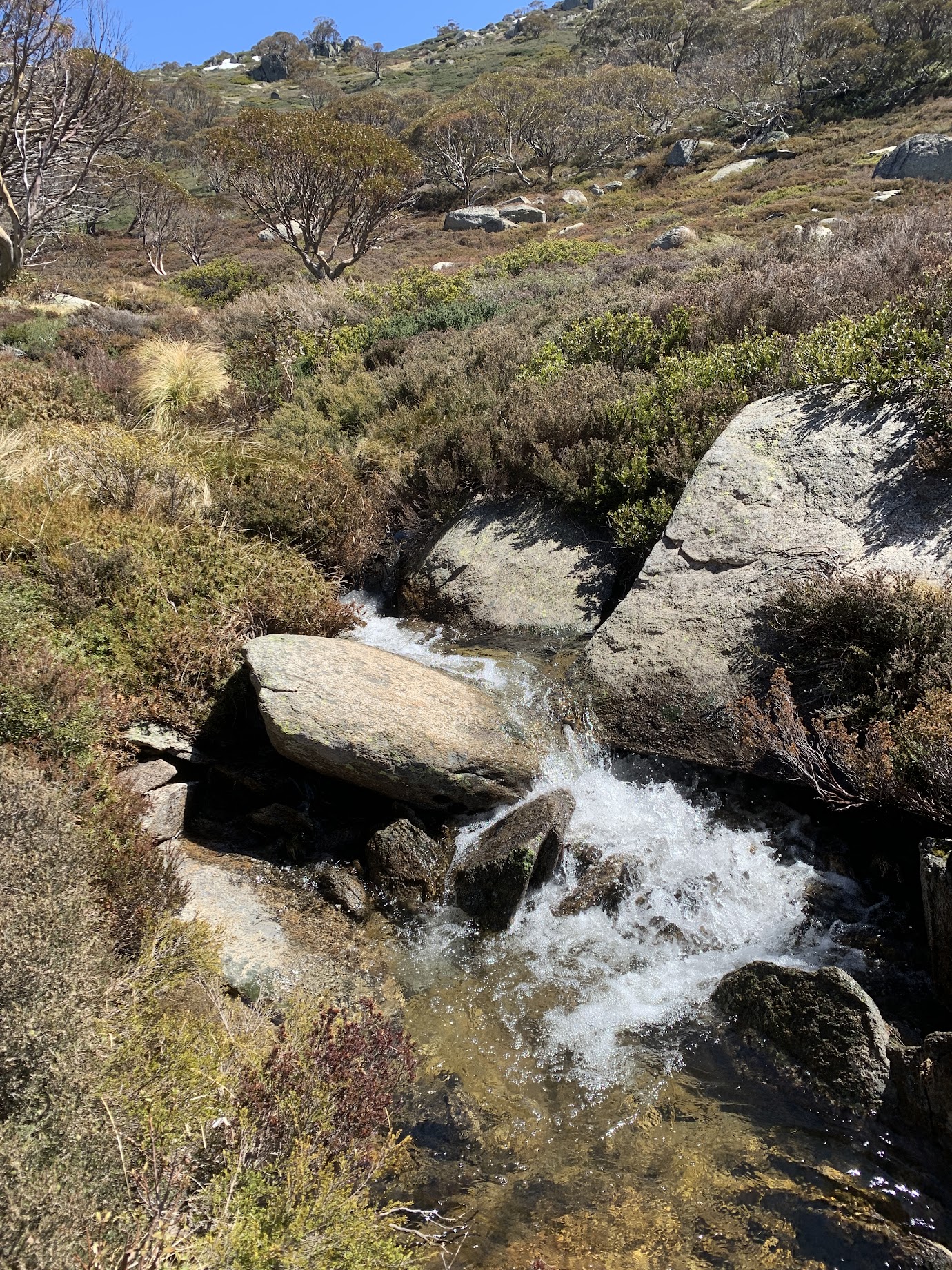
Second creek
Walking NW back towards Charlotte Pass village, Wrights Creek was again crossed.

Bridge over Wrights Creek
The village was in sight, but another km or so had to be walked to gain it.
A wonderful trip, thanks Mike and all!
Party
4 walkers – Mike B (leader), Margaret P, Brian S, me.
AllTrails
The AllTrails map is here, where you can pan and zoom.
Johnny Boy’s Walkabout Blog FaceBook Page
I’ve started up a FaceBook page. Each trip report posts to it. It’s another way to get some info to get out and breathe a bit of fresh air. Why not pop over and Follow the page, or give a post a Like.
Additional Trip Reports
As I age, I’m doing a few more simple hikes. I don’t always produce a full trip report. If you’re interested, you can find details of them on the Completed Walks tab. There you can access the trip’s map segment, download a gpx file, see the distance, climb and grading, and link through to the photo album. Additional metrics are available by looking at the start waypoint on the map segment – moving time, stopped time, total time.