Lunch views
Monday 12 August 2024: The Paralyser Snowshoe – 2B. Our primary objective will be to reach Trig Point SMA0318 just to the south of Guthega. Depending on our progress, we may explore the area around The Paralyser about 1 km south of the trig and/or we may descend directly to Illawong Hut on the return leg. Depart Calwell 6:15 am. Afternoon tea at Basecamp Cafe, Guthega. Date may be changed (forward or back) depending on weather and snow conditions.
Chains may be required. Participants hiring snowshoes should be in possession of them prior to departure. Participants should have good hiking fitness.
Summary
From Garmin Connect (recorded on Epix Gen 2) – Distance: 10.66km | Climb: 530vm | Time: 3:26 moving +2:18 of stops = 5:44 | Grading: NPA 2B, M/R; M(11).
Photographs
View photographs here.
gpx file
Download the gpx file here.
Track Map
Here’s where we went. 20m contours always fool me.

Track The Paralyser Snowshoe
Trip Report
I last did this trip led by Mike B on 21 Aug 23. Last year was in the reverse direction to today.
We met in Calwell and motored to Guthega (thanks Stephen).

Plenty of Monday people at Guthega
We geared up quickly and walked a couple of hundred metres to shoe up at 9.20am.
The Pondage frozen.

Guthega Pondage frozen over
A bit of exposed shrubbery as we tracked south to the Farm Creek bridge and clacked across it.

Heading S to the Farm Creek bridge
The steep climb up the spur began immediately and I was soon puffing. But great weather, blue sky, no breeze and the layers soon came off to t-shirt and shorts.

A gruelling climb S up the spur
On and on, climbing 320vm to smoko.

Still climbing
At last our objective was in plain sight.

Approaching SMA0318
Great views from the top.

The ladies at SMA0318 trig
I thought I’d best get a shot of self, since I might not be back next year.

Johnny Boy
Here’s a vid from the top.
With time on our side, we shoed further south to lunch.

Heading towards the Paralyser on the Perisher Range
Stephen had a little explore up along the top. For those of us who flanked the top, some great tors.
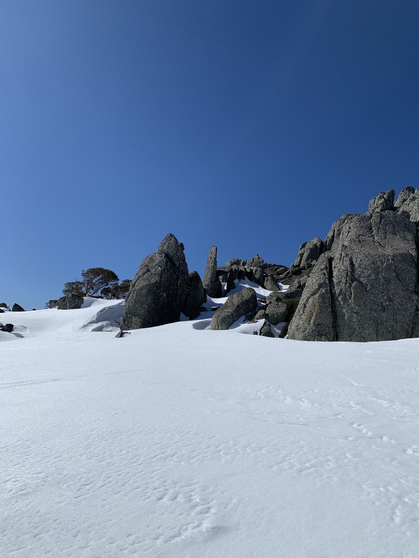
Rock stacks on the Perisher Range just N of lunch
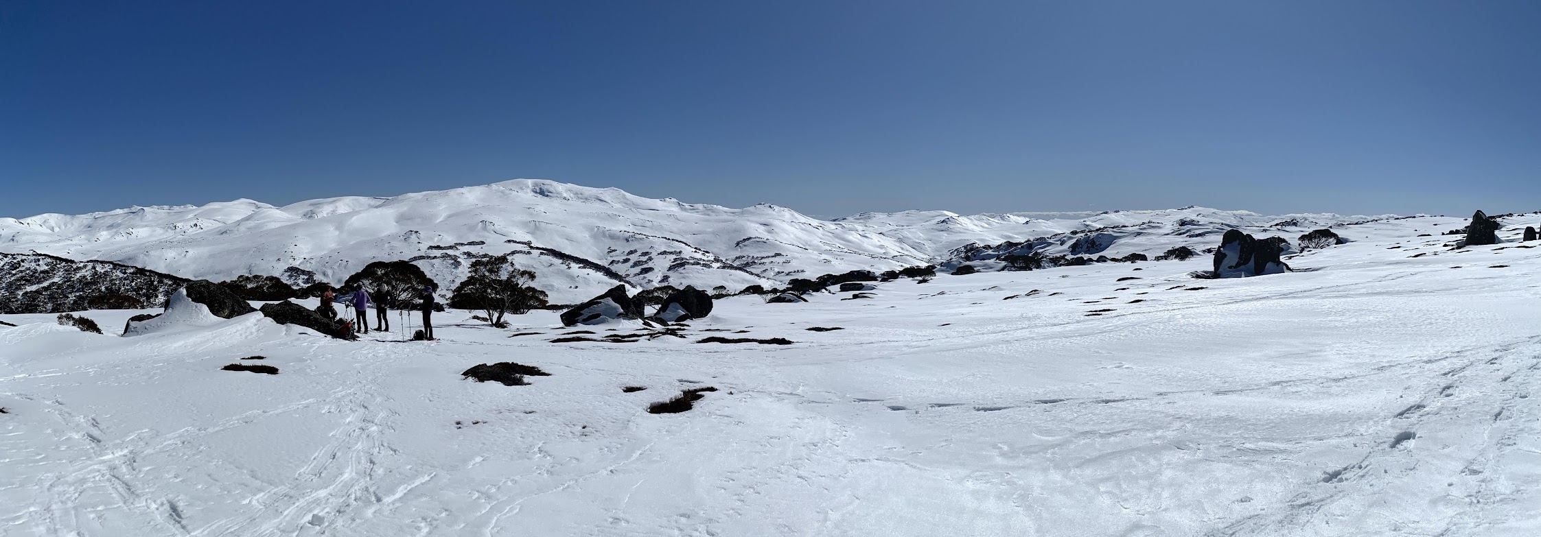
The views from lunch were superb!

Lunch views
We left at 12.45pm, the plan being to sidle down and across to Illawong Hut. The word “down” revived me.

Heading down from the tops towards the Snow Gum belt
The colours of the Gums are fabulous.

Snow Gum
We handrailed the Snowy River for a while.

The Snowy River
We recrossed the bridge.

Farm Creek bridge
The final climb at the end of the day up to Guthega saw me arriving a well distanced last.
Coffee and cake. Great conversation with my driver.
Thanks Mike for putting this on and for Mike and Stephen driving. Convivial company with Margaret and Sandra.
I was pleased with my snowshoes on their second or third outing. They’re MSR Revo Explores, extra long, extra weighty, extra grippy. They did a great job climbing, descending and contouring.
Party
5 walkers – Mike B (leader), Stephen M, Margaret P, Sandra T, me.
AllTrails
The AllTrails map is here, where you can pan and zoom.
Johnny Boy’s Walkabout Blog FaceBook Page
I’ve started up a FaceBook page. Each trip report posts to it. It’s another way to get some info to get out and breathe a bit of fresh air. Why not pop over and Follow the page, or give a post a Like.