
Admiring Rob Roy Falls
Saturday 10 August 2024: Rob Roy Nature Reserve, Mountain and Falls * – M/M-R,ptX. The Rob Roy Nature Reserve is getting plenty of walking at the moment, so let’s keep it up. Climb via the creek behind the flood mitigation wall and an open spur to meet the Banks Steep Track. Fire trail to Mt Rob Roy. Descend West through woodland to the grasslands. Follow a creek down to the top of Rob Roy Falls for a spectacular view. Return via Big Monks and a helter-skelter down to the edge of Banks. Around 11km and 620vm.
Summary
From OziExplorer (recorded on MAP66i) – Distance: 12.26km | Climb: 700vm | Time: = 6:20 | Grading: M/M-R,ptX; M(11).
Photographs
View photographs here.
gpx file
Download the gpx file here.
Track Map
Here’s where we went.

Track Rob Roy Nature Reserve, Mountain and Falls
Trip Report
I was last at the Falls on 3 Aug 24. Photos here.
A nice little trip (if I do say so myself), passing through a number of different ecosystems. Creek lines, fire trails 😒, woodland, grasslands, the great falls, and hill tops for views.
Walking at 8.20am and instead of plugging up the tarred Banks Steep Track, we followed the creek up behind the flood mitigation wall, then an open spur to join that track after the sealed section finished.

Heath flowering in Rob Roy Nature Reserve
Fire trail had to be endured to Mt Rob Roy, the last few hundred metres up a footpad.

The footpad to Mt Rob Roy
.Smoko at the top. Not much of a view as it’s treed in.
Then a very pleasant descent to the open grasslands through woodland.

The bottom of our descent from Mt Rob Roy
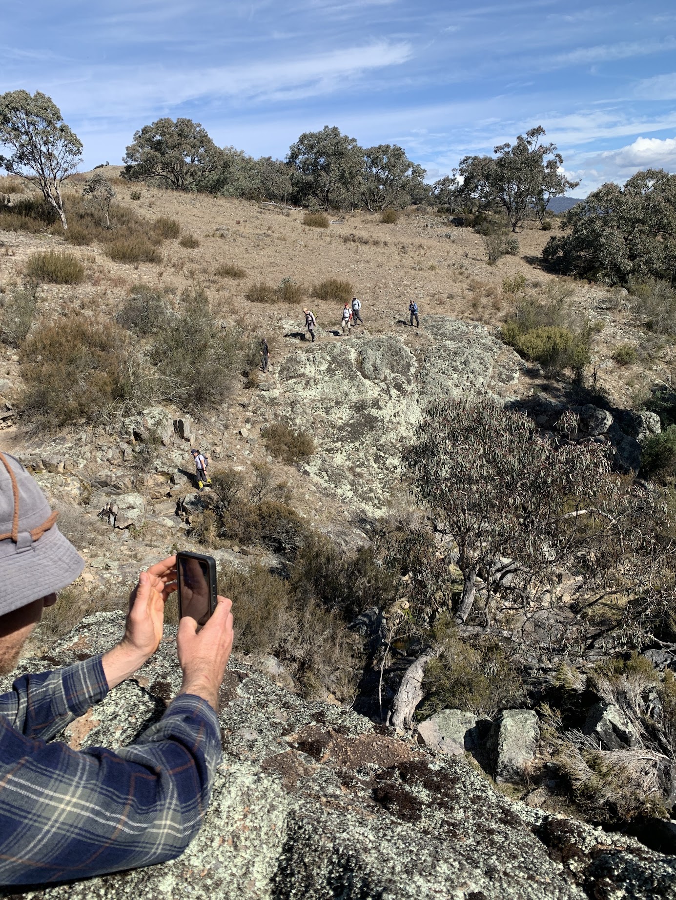
Crossing the western flank fire trail of the Rob Roy Range, we walked generally west across the grasslands and creek lines to sidle round the southern side of Rob Roy Falls. Wedge-tailed eagles soared.

Approaching Rob Roy Falls
A little rock skipping at the bottom.

Rob Roy Falls
Although a couple in the party would have been capable of climbing up the falls, I was keen to keep the group together. So we safely circled up to the top of the falls for views down and lunch.

Rob Roy Falls from the top
Nice in the sun for an unhurried time.
We exited from the falls via the creek line. A little more rock hopping.
Skirting a rocky bowl on Rob Roy Creek
Out of the creek and back on the grasslands, we walked west up the beginning of a series of knolls.

Mt Tennent from Knoll 1
We walked north to Big Monks.

Houses and hills from Big Monks
Then across to ‘Little Monks’ with its Kurrajong tree and stone throne.
We dropped down to the Black and White Mine.
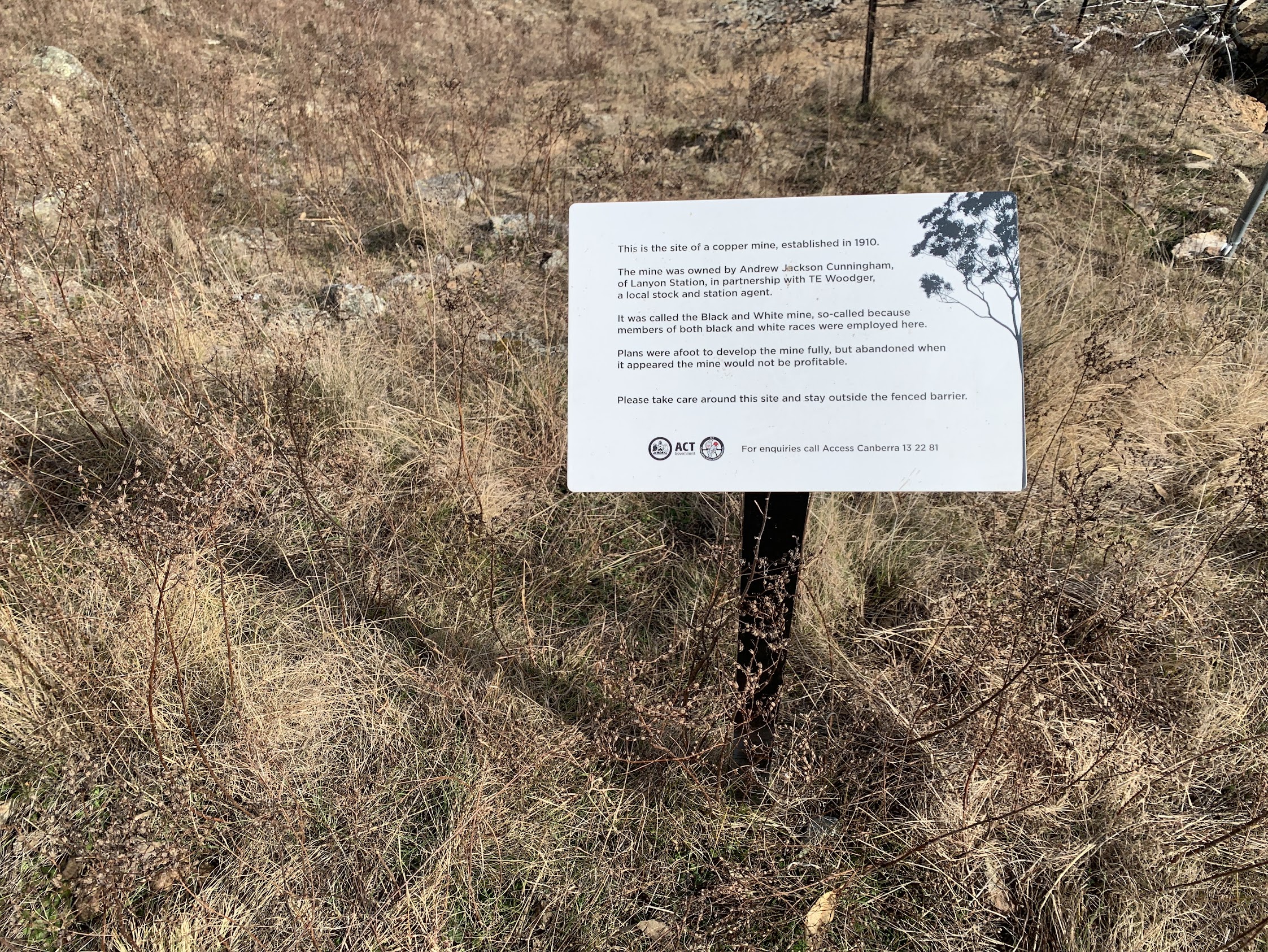
Signage at the Black and White Mine
We chose the option to continue down the spur to the SE corner of Banks, then along the fire trail back to our cars.
A very pleasant round. Trust you enjoyed it.
Party
11 walkers – Rochelle C, Michael C, Shell D, Jan H, Trevor L, Hsu L, John M, Cole N, Stef P, SF Lam, me.
AllTrails
The AllTrails map is here, where you can pan and zoom.
Johnny Boy’s Walkabout Blog FaceBook Page
I’ve started up a FaceBook page. Each trip report posts to it. It’s another way to get some info to get out and breathe a bit of fresh air. Why not pop over and Follow the page, or give a post a Like.