
Exploring near smoko
Sunday 13 October 2024: Super Week of Walks #9 – Granite Labyrinth: ‘Temple of Doom’ * – M/R,X. This walk is part of CBC’s Super week of Walks celebrating the 40th year of Namadgi National Park, the Canberra Bushwalking Club and bushwalking in general.
A there and back to a fabulous granite tor formation locally known as the ‘Temple of Doom’, thanks to Ian W ‘the granite hunter’. From the watershed bend in the Nursery Swamp Walking Track, head around 1.5km and 250vm up to the site to explore the feature, which is SE of Mt Orroral. Expect to be amazed. Return the same way. Around 8km and 460vm climb. Bring a torch. Thick scrub and rock scrambling. For robust off-track walkers.
Summary
From Garmin Connect (recorded on Epix Gen 2) – Distance: 9.51km | Climb: 505vm | Time: 2:30 moving + 3:00 of stops = 5:30 | Grading: M/R; M(11). I reckon CBC and BBC ought to include an age factor 🤣,
Photographs
View photographs here.
gpx file
Download the gpx file here.
Track Maps
Here’s where we went.

Track Temple of Doom
Trip Report
I was last at the Temple of Doom on 11 Jun 13 and 26 Jun 12. Both those routes were a lot more difficult than today. And I am 12 years older.
In my estimation, today was a shocker and certainly my swansong in this area. Painfully slow going uphill (thanks for taking some of the lead Damian), couldn’t find the caverns and crawls in the Temple of Doom and the exit was enough scrub for even me.
At some stage during the day we visited the NS3 art site. We lunched at NS2 (which many people know about and visit) but no photos of it.
From Nursery Swamp car park up the NSWT to the crest above Nursery Creek 2km in 40mins.
Here we turned uphill and covered the 1.2km to near the ‘Spherical Tors and the ‘Orroral glacier” waypoint (it was winter when it was named!) in 1hr 10mins. The climb was 180vm. Some hard going for me.

The country at 1250m, photo 001
From here, we headed across the drainage line.

Photo 002 at 1340m
A little easier going as we went W-ish towards our objective.

Photo 003 at 1370m
The Temple of Doom is a very large area of granite tors. The edge appeared.

Photo 004 at 1380m
We found a way up to a part of the Temple of Doom, enjoyed the views for morning tea, and had an explore.

Exploring near smoko
Unfortunately I couldn’t find the main tunnels and crawls.
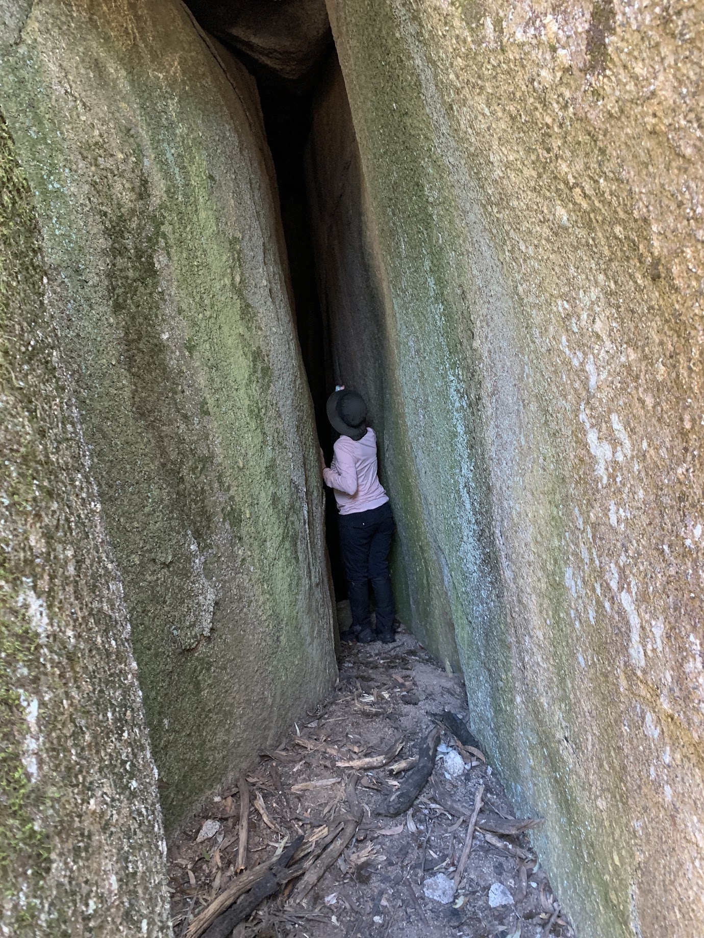
Exploring near smoko
We left the area at 11.40am

Photo 008 Leaving Temple of Doom area
Instead of retracing our steps, we circled W, S and SE to Nursery Creek. Downhill, thank goodness, but still very scrubby and really not interesting country.
Pulled into lunch at 12.40pm, the 200vm descent of 1.4km taking 1hr.

Lunch
Exited via the old visitors book.

NS2 Visitors book
Lunch to gaining the NSWT was through more open country, handrailing above Nursery Creek. Bits and pieces of the old footpad used. 1.5km in 35mins.
Down the NSWT to the cars.
Most of the party had not walked in this area above Nursery Creek, so at least that was a plus. Thanks for holding my hand folks.
Party
7 walkers – Mike B, Joe C, Garry C, Anna G, Nadege K, Damian S, me.
AllTrails
The AllTrails map is here, where you can pan and zoom.
Johnny Boy’s Walkabout Blog FaceBook Page
I’ve started up a FaceBook page. Each trip report posts to it. It’s another way to get some info to get out and breathe a bit of fresh air. Why not pop over and Follow the page, or give a post a Like.
Additional Trip Reports
As I age, I’m doing a few more simple hikes. I don’t always produce a full trip report. If you’re interested, you can find details of them on the Completed Walks tab. There you can access the trip’s map segment, download a gpx file, see the distance, climb and grading, and link through to the photo album. Additional metrics are available by looking at the start waypoint on the map segment – moving time, stopped time, total time.