
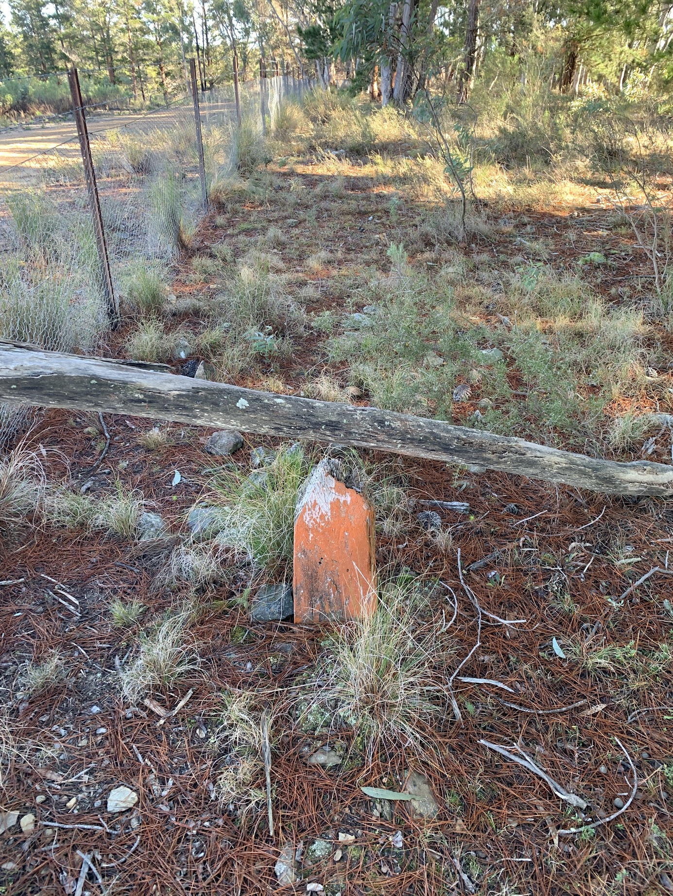
Border marker P1
Tuesday 27 August 2024:
ACT Border Walk section 1: Kowen from Kings Highway to Sutton Road * – L/E. A trip planned by Jonathan M and executed by me.
Summary
From Garmin Connect (recorded on Epix Gen 2) – Distance: 23.05km | Climb: 660vm | Time: 5:14 moving +1:10 of stops = 6:24 | Grading: L/E-M; H(12).
Photographs
View photographs here.
gpx file
Download the gpx file here.
Track Map
Here’s where we went.

Track NE Border of ACT – Sutton Rd to Kings H’way
Want the gory details?
If you are interested in the ACT border survey, have a look here and drill down. There are photos of every border marker, blaze tree, mile marker that I’ve ever found.
The ACT Government has digitised and made publicly available the extant field notebooks from the original 1910-15 survey. Only trouble is they keep on reorganising their web sites and stored links produce a 404. As at 27 Aug 24, you’ll find them via actmapi.act.gov.au – /fieldbooks/. The ones covering this area of the border are 284 (https://actmapi.act.gov.au/fieldbooks/A169-485/A_284/A0284.pdf) and 291 (https://actmapi.act.gov.au/fieldbooks/A169-485/A_291/A0291.pdf).
Trip Report
I last did this section of the ACT border as two day round trips on 9 Nov 10 and 18 Jan 11.
As usual there were whoopsies. I combined Jonathan’s planned car shuttle with my desire to walk clockwise mainly away from the sun, to caused Greg to needlessly drive up the Sutton Rd instead of meeting him at Spotlight in Queanbeyan. I was talking too much and missed following the ACT border where it loops down to the Kowen fire tower and also missed a planned visit to Mt Cohen.
My companions had not been here before, so some interest. For me, it was worth revisiting border markers, lockspits, blaze trees and mile markers placed by Percy Sheaffe over 110 years ago.
All on fire trail and not that interesting scenery, but one has to do it and ‘every walk is a good walk.’
Away at 8.20am and an immediate puff up the hill to the top of the Kowen escarpment. A find of border marker P1 (see pic above) whetted our appetite.
Some black cockies.

Yellow tailed Black Cockatoo
I had a glance at many of the border corners, but this was not serious hunting and I didn’t want to bore my companions. Here’s a burnt K2.

Border marker K2
The nearby L2 was another surviving example.
Border marker L2
Walked through Poppet Hill and trig.
Poppet trig
The top of L3 was a little hard to spot at the top right of the stone.

Border marker L3
Here’s an example of the country. Hard fire trail and lots of pine trees.

The way ahead to Amungula Hill
Smoko at Amungula trig, 50m off the border.

Amungula trig
Amungula was one of the high points (above sea level or interesting 😂), Poppet 918m, Amungula 915m, Cohen 918m, Bald 899m. But some decent ups and downs in between.
Another typical view was the harvested areas. Some already replanted.

Harvested and bare
National colours.

Green and gold
A lockspit is a row of rocks, each arm pointing in the direction of the border, with the border corner marked in the middle. Here’s a great example, R5.

Lockspit R5
We dropped down from the border to visit (walk around the perimeter) of the Canberra Geophysical Observatory. Is it still in use?

Canberra Geophysical Observatory
Back up on the border and after munch, we stopped at border marker B6’s blaze tree. Blaze trees are becoming nearly as rare as hen’s teeth. Age, fire, bulldozing (before their heritage value was recognised) have taken their toll. Each of the thousands of border markers originally had two nearby trees blazed. A review of the extant trees in 2015 revealed that only 64 still could be found.

Border marker B6 blaze
C6 was another well-defined lockspit, the border being nearly a straight line here.

Lockspit C6
H6 had a nearby blaze tree but unfortunately the chiseled markings were not decipherable.

H6 blaze
As well as border corners, the original surveyors marked each mile with a cairn, clockwise from Mt Coree.

35 Mile marker
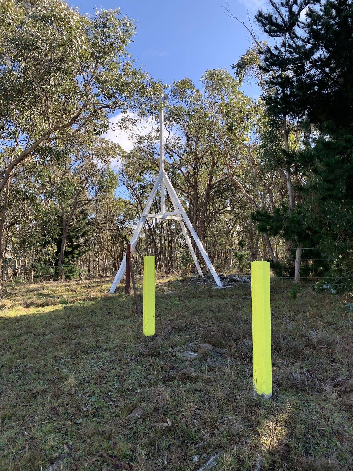
At last we made it to Bald Hill and knew that the car was around 1+km down from here.

Bald Hill infrastructure, trig and views
As a last piece of interest (to anyone but me?) we came across a re-surveyed border marker, as indicated by the small square-topped white peg.

Re-surveyed border marker U6
A last salute to the pine logging in the area.

Log loading ramp made out of logs
Party
3 walkers – Greg B, Tam G, me. Plus a vicarious Jonathan M?
AllTrails
The AllTrails map is here, where you can pan and zoom.
Johnny Boy’s Walkabout Blog FaceBook Page
I’ve started up a FaceBook page. Each trip report posts to it. It’s another way to get some info to get out and breathe a bit of fresh air. Why not pop over and Follow the page, or give a post a Like.
Additional Trip Reports
As I age, I’m doing a few more simple hikes. I don’t produce a full trip report. If you’re interested, you can find details of them on the Completed Walks tab. There you can access the trip’s map segment, download a gpx file, see the distance, climb and grading, and link through to the photo album. Additional metrics are available by looking at the start waypoint on the map segment – moving time, stopped time, total time.