
30 October 2010 The real Black Springs
Map: Tidbinbilla 1:25000
Getting There
This walk was organised by Mike B and led by me as an NPA/CBC walk:
Saturday 30 October 2010 – The real Black Springs. - L/R,ptX. A combined NPA/CBC walk from Tidbinbilla via Fishing Gap to the real Black Springs on the Cotter River. Apparently the real Black Springs are located about 1 km downstream of where they are shown on the map. Around 15 km, 800 m total climb including thick regrowth and river crossings. Expect about 10 hours of walking time. Limit of 8. Map: Tidbinbilla 1:25000. Leader: John E. Transport: $32 per car, $8-10 per person. Further Information: NPA Bulletin, Vol. 23 No. 3, March 1986, page 18.
4 of us met and drove to Tidbinbilla Nature Reserve. Mike B also drove out. The gates are open from 7.30am during Eastern Summer Time. We drove on and parked at Fishing Gap car park
Further Information
Unfortunately Mike is still not able to wander far, so he's given the nod for this walk to go ahead.
Access all primary pics here. All thumbnails in the walk report are active - click for a larger picture.
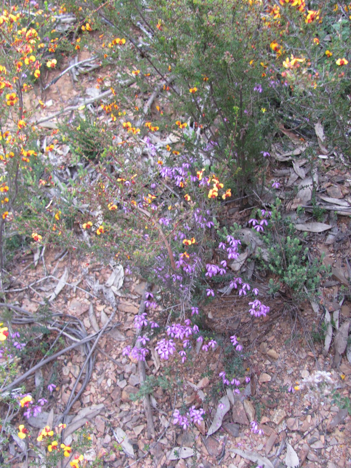
Mike walked to Fishing Gap with us and, on his return journey, took some magnificent photos of wildflowers.
Walk
|
| Track The Real Black Springs |
Walking by 7.40am and did the 3.7km to Fishing Gap in 45mins. Here we parted company with Mike.We spied a freshly taped and vegetation reduced route which headed off down the creek line from Fishing Gap, so decided to follow it - was this the renaissance of the pre-2003 fire track down to the Cotter? It wound down the drainage line, often literally in the creek which, with all our recent rain, was soon running. Heavily taped and freshly and well cleared through regrowth, so a serious effort.
ANYONE KNOW ANYTHING ABOUT THIS ROUTE - WHO PUT IT THERE AND WHERE IT GOES? TNR and NNP rangers don't.
 |
| The creek flowing down from Fishing Gap |
An initial bonanza and we followed it down for 725m. But it left the creek to not return and we found ourselves heading up the ridge on the N side of the creek. We saw the last tape at UTM 55H 669217-6071554 (MGA94) and sat down to determine what was what. By this stage we'd covered 1km from Fishing Gap in 35mins. There was nothing to do but to stay on this side of the creek (Rod kindly said that he'd wanted to visit the scree on this side, after our return up the other side on 10 Apr 10). It was a succession of scree slopes, regrowth, a couple of small cliffs - all with left leg longer that the right as we contoured across the side, dropping from 1100m at the last tape to 950m at morning tea. An exhausting 1.4km in 1hr 10mins. We deserved our 15min break, sitting on a substantial open rocky outcrop with views across to the 'grass-is-greener-on-the-other-side' of the creek line and views down to the white quartz ridge above the map-marked Black Springs, still a long way off. Another 1km in 45mins had us down near the creek from Fishing Gap and we angled NW across the spur coming up from the Cotter.
 |
 |
 |
 |
 |
| Scree on the N side of the creek flowing down from Fishing Gap | Rock walls on the N side of the creek flowing down from Fishing Gap | Looking back to the scree we'd trodden on the N side of the creek flowing down from Fishing Gap | View across to the S side of the creek flowing down from Fishing Gap - our return track | View down the creek from Fishing Gap to the Brindabellas |
Dense regrowth as we climbed the SE facing side, over the crest and into a rare more open patch of vegetation as we tracked W of N down towards the Cotter River. Down off the ridge it was absolutely dense regrowth, but I did want to hit the river here with thoughts of crossing it to perhaps get a better view of the real Black Springs and to sus out the area contained by the big upside down U of the Cotter River. 33mins for this 600m leg.
 |
 |
| A rare patch of easier going on the leg N to The Real Black Springs | Cotter River looking downstream as we approach The Real Black Springs |
Withdrawing from the river bank back into the scrub, we pressed on for another 300m in 15mins until the bank was impassable without climbing up and over the cliffs in front of us. 12 noon by now, threatening weather, black cliff face with a small soak seeping down - I was happy to claim a bag. (I guess I'll return if Mike or Max put the walk on again, but this is not easy country.) Lunch beside the beautiful Cotter River.
 |
 |
| The Real Black Springs | The Real Black Springs |
Away again at 12.20pm on the only other option availabe - a higher route than the inward leg. Slightly easier going and a nice view down onto the river. The return leg of 1km to cross the creek coming down from Fishing Gap to the S side took 42mins.
 |
| Cotter River from higher return leg |
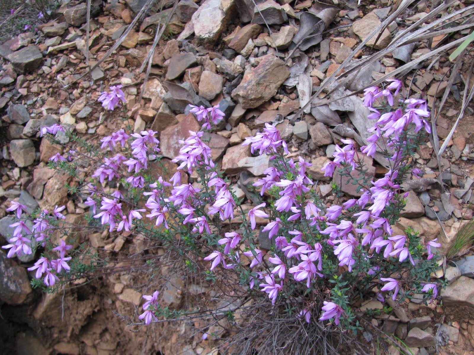
With promises of an easier homeward leg from this point than the trip in on the N side, we broke out of the tight scrub along the creek and into the tantalisingly open area at the bottom of the spur. A patch of the old benched track is recognisable. But the easy going does not last long and it was a constant climb up across alternating gullies and spurs. However, it was certainly easier than the N side - great views across to its scree slopes and our morning tea rocky outcrop. Some nice wild flowers.
 |
 |
 |
 |
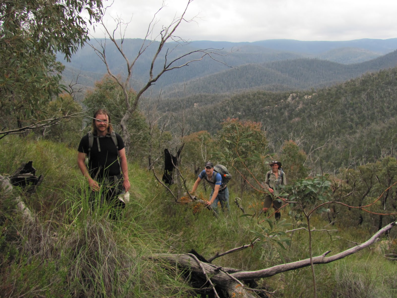
| A profusion of wild flowers | View to N side morning tea spot from S side | Llewellyn, Lucas and Rod enjoying the climb back up to Fishing Gap | ACT's territorial flower Wahlenbergia gloriosa (Royal Bluebell) |
It started showering around an hour before we reached Fishing Gap and the last 30mins turned to rain. Not worth putting a coat on - we just got soaked. 2hrs 45mins to do the 3.3km and 300m climb. Rod spied a nice feature up on the ridge above us which perhaps deserves a visit.
 |
 |
 |
 |
| Crossing a side creek on the return leg | Wild flowers | Nice feature at around UTM 55H 669189-6070659 (MGA94) | Grevillea flower |
A dawdle down from Fishing Gap to the car - 3.7km in 52mins.
We stopped at the Visitors Centre and had an ice cream. The staff there had no knowledge of the taped track - must ring a ranger to ask.
Many thanks for your company Llewellyn S-P, Lucas M and Rod G. A bit harder than I was expecting.
Distance: 16.1km Climb: 800. Time: 7.40am - 4.40pm (9hrs), with 35mins of breaks.
Grading: L/R,ptX; H(14)
KMZ file for Google Earth/Maps: The Real Black Springs
Back to Walks Index
This page last updated 23Aug22